Our Work
Featured Projects
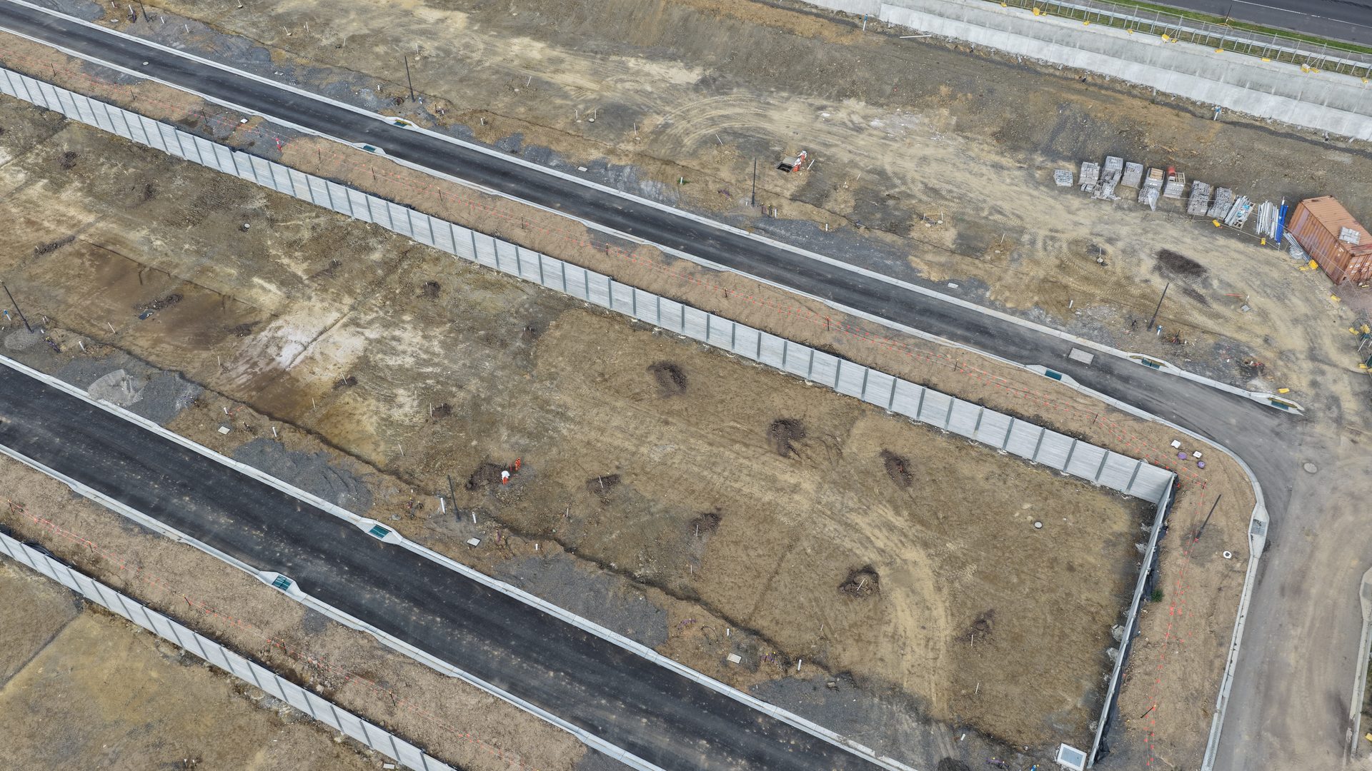
Delivering aerial intelligence to civil and residential developments across Melbourne and regional Victoria.


DroneX Civil delivers precision aerial mapping, photogrammetry, and progress-tracking solutions for the construction and land-development industry across Melbourne and Victoria.
Projects Completed
Site Visits
Aerial Images Captured
What We Do
From high-resolution mapping to 3D photogrammetry models, we provide the aerial data your project needs to stay on track and on budget.
High-resolution orthomosaic maps and topographic datasets using RTK-enabled drones with centimetre-level accuracy for civil earthworks, subdivisions, and land development.
Detailed 3D reality models built from thousands of aerial and ground-level images. Ideal for progress documentation, quantity verification, and stakeholder presentations.
Regular scheduled fly-overs to document construction milestones, compare progress against design plans, and provide time-series visual records for project managers and clients.
Drone-captured aerial evidence for remote council and authority inspections. When site visits aren't possible, our aerial documentation provides the visual proof needed for sign-offs and approvals.
Our Work
Delivering aerial intelligence to civil and residential developments across Melbourne and regional Victoria.
Interactive
Explore our project sites in full 3D. These interactive models are built from thousands of drone-captured images processed through advanced photogrammetry software.
Drag to rotate, scroll to zoom. Complete photogrammetry reconstruction of the Chirnside Park development.
Ground-level photogrammetry capture of the May Road construction site built from hundreds of high-resolution images. Drag to rotate and explore.
How We Work
A streamlined process designed to get you actionable aerial data as quickly as possible.
We discuss your project requirements, site conditions, deliverable formats, and establish a flight schedule aligned with your construction programme.
Automated waypoint missions are programmed to ensure complete site coverage with optimal overlap for photogrammetry processing.
On-site drone operations capturing high-resolution imagery, video, and GPS-tagged data. All flights comply with CASA regulations.
Raw data is processed into orthomosaics, 3D models, progress reports, and comparison overlays shared via cloud platforms.
About Us
DroneX Civil was founded by a civil engineer with hands-on experience in land development, subdivision design, and construction project management across Melbourne. That engineering background means we understand what you actually need from aerial data — not just pretty pictures, but actionable intelligence that supports real project decisions.
We started during COVID-19 when authorities couldn't attend construction sites for inspections. Our drone captures became the solution — providing the aerial evidence needed for remote approvals and keeping projects on track when traditional inspection methods weren't possible.
Get In Touch
Ready to add aerial intelligence to your next civil or construction project? Reach out for a free consultation and quote.
info@dronexcivil.com.au
Greater Melbourne & Regional Victoria
86 689 641 987